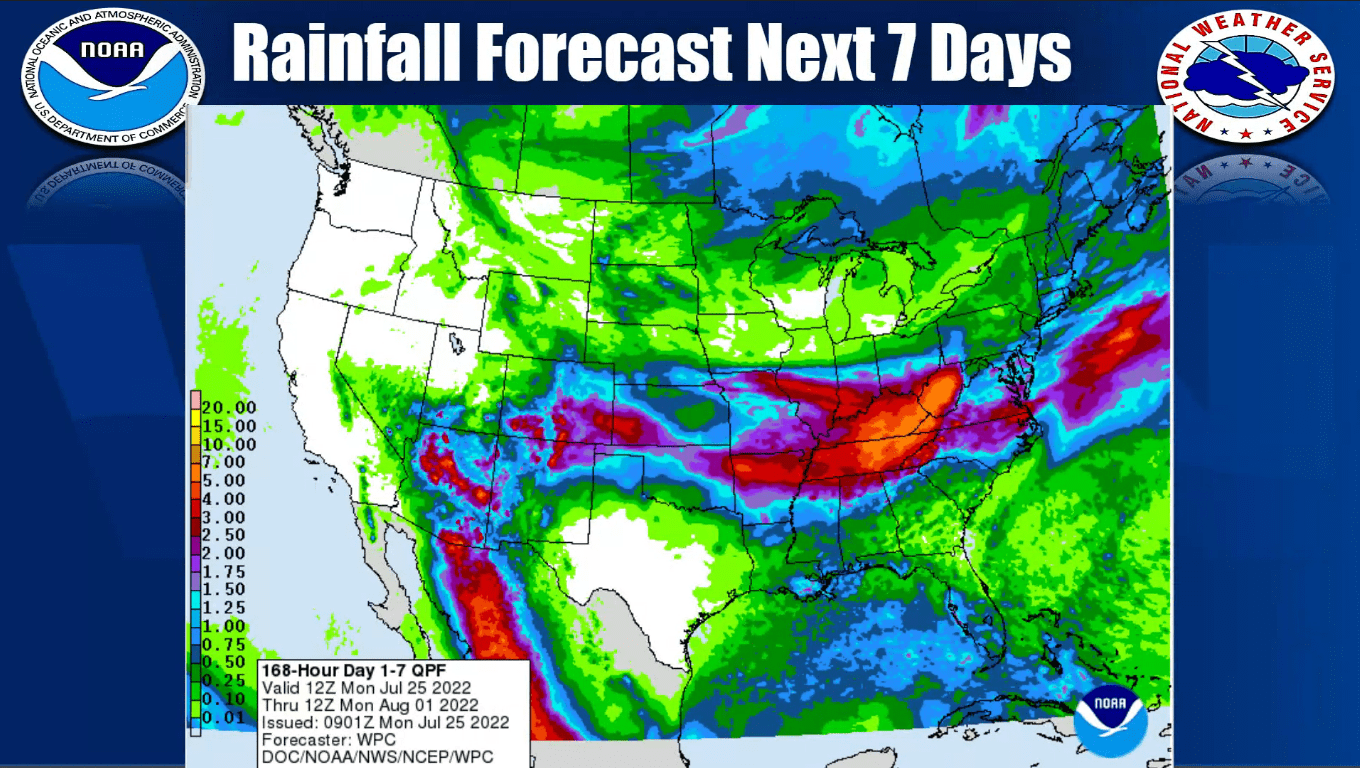
Western Kentucky could see some much-needed rainfall this week although the heat will continue to stick around the first part of the week.
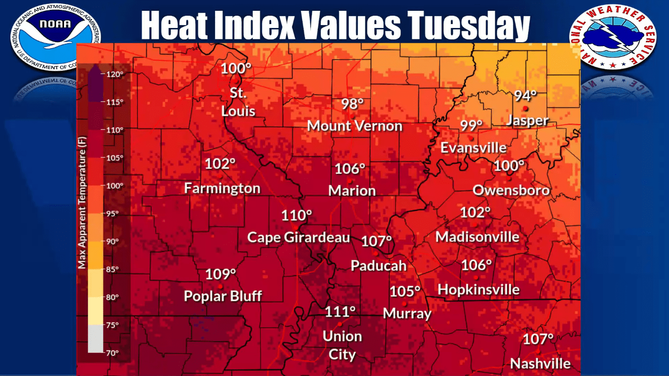
Christine Wielgos, the warning coordination meteorologist for the National Weather Service in Paducah, said the area will continue to see heat index values in the 105-degree range again Tuesday.
click to download audioShe said the main reason for the continued heat is a stationary front in the plains.
click to download audioThe combination of the stationary front and the heat means western Kentucky is at a marginal risk of severe weather for Tuesday and Wednesday.
click to download audioSo how much rain can be expected for a region over two inches below normal for July? Wielgos said a couple of inches depending on where you are.
click to download audioAs we make to transition to August, Wielgos said temperatures will likely be a touch below normal but they aren’t as sure on projected rainfall.
click to download audioMost locations in western Kentucky have passed 30 inches of rain this year and are approaching average totals for this time of the year after seeing it range between five and seven inches above normal in the spring.