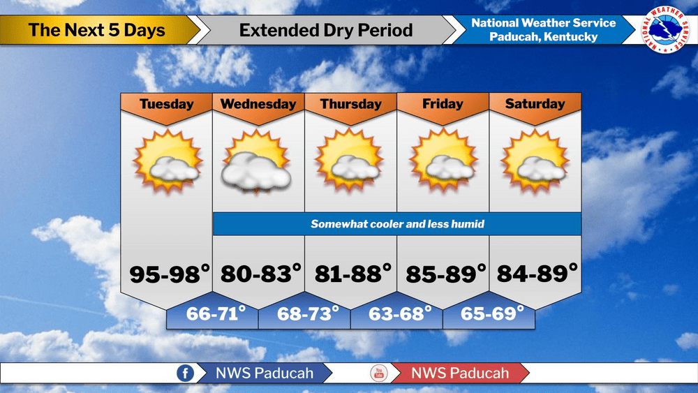
The first week of August has brought temperatures at or above normal and that is not expected to change through at least midweek.
Lead forecaster Justin Gibbs with the Paducah Weather Service office said Tuesday’s temperatures in the mid to upper 90s may trigger a heat advisory with borderline heat index readings in the 100 to 105 range.
Gibbs said a front will pass through the area around midweek and bring lower dew points and cooler temperatures to end the week.
click to download audioGibbs also said the front looks dry so they are not expecting any rain through the weekend, which continues a good balance of rain and heat.
click to download audioHe said the extended forecast for next week also looks seasonal although there could be some rain.
click to download audioGibbs said the Paducah Weather Office has tracked 57 tornadoes in 2024, the most since 2011 when 79 were confirmed. However, this year’s tornadoes have tracked for 442 miles, which is just seven fewer than all of 2011.
As far as the temperatures go, July marked the third straight year of six days of 90-plus degree days for the month after 2021 saw 14 days with the mercury above 90.