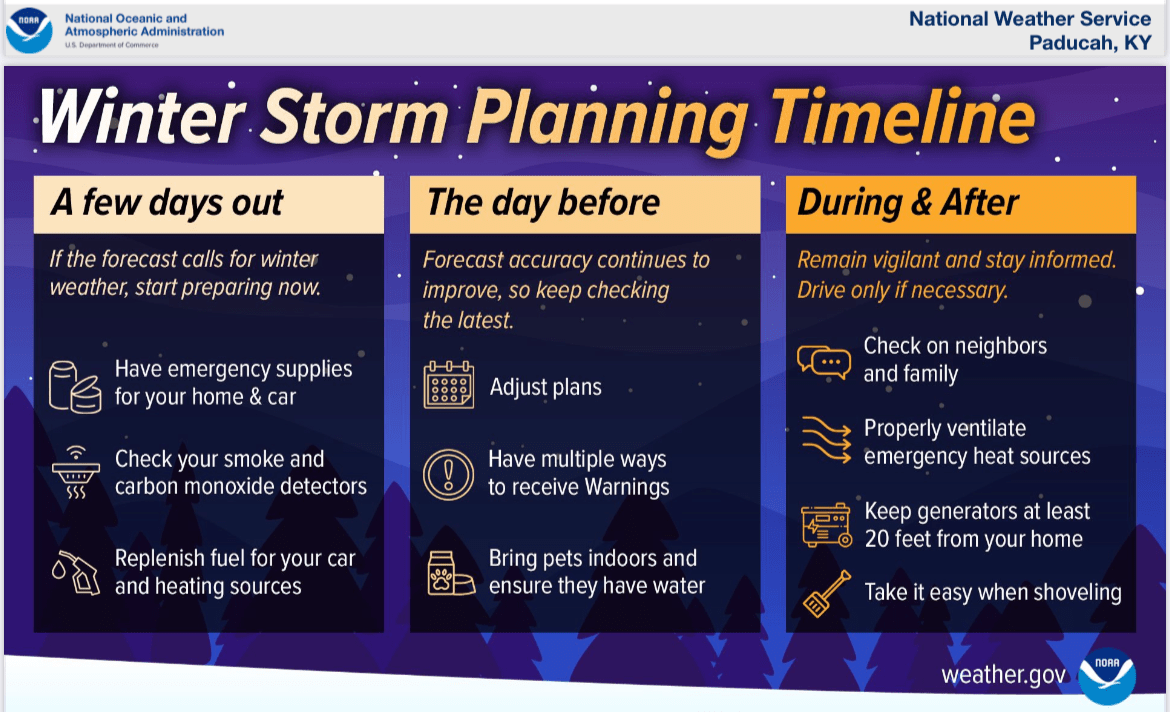
The National Weather Service says severe weather and torrential downpours are over but a very busy forecast continues.
Forecasters say there are some threats to keep an eye on.
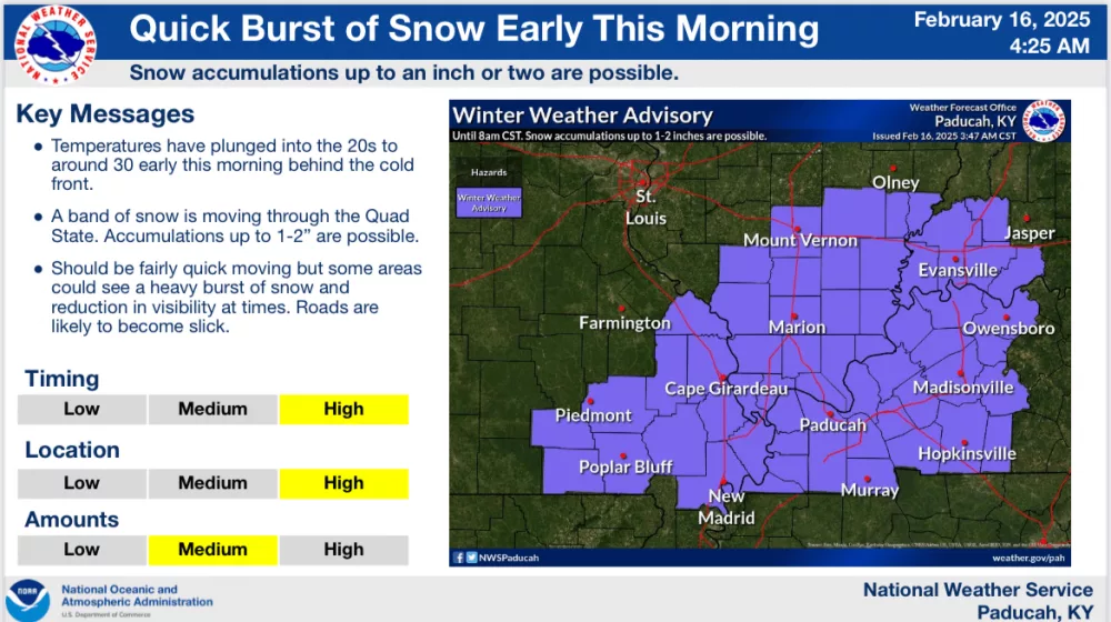
1. A quick moving snow band is produced decent rates of snow early this morning and resulted in 1-2 inches of snow. A Winter Weather Advisory remained in place until 8 am for the entire forecast area.
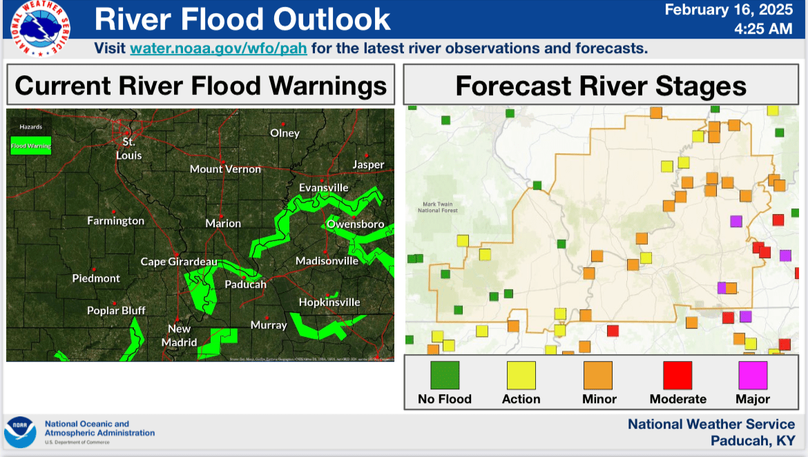
2. Flooding issues continue as water levels recede from yesterdays’ heavy rains. Rivers are rising, with many expected to flood. The Green River is forecast to rise to moderate t (Paradise) to major (Calhoun) flood. The Ohio River is forecast to reach minor flooding at many points along the river. The Little River is cresting and will drop below flood stage later today.
3. Snow forecasts for the Tuesday-Wednesday system continue to trend higher with a 30-80% chance of 6+ inches of snow. The highest chances are in SE Missouri while the lowest are along the I-64 corridor.
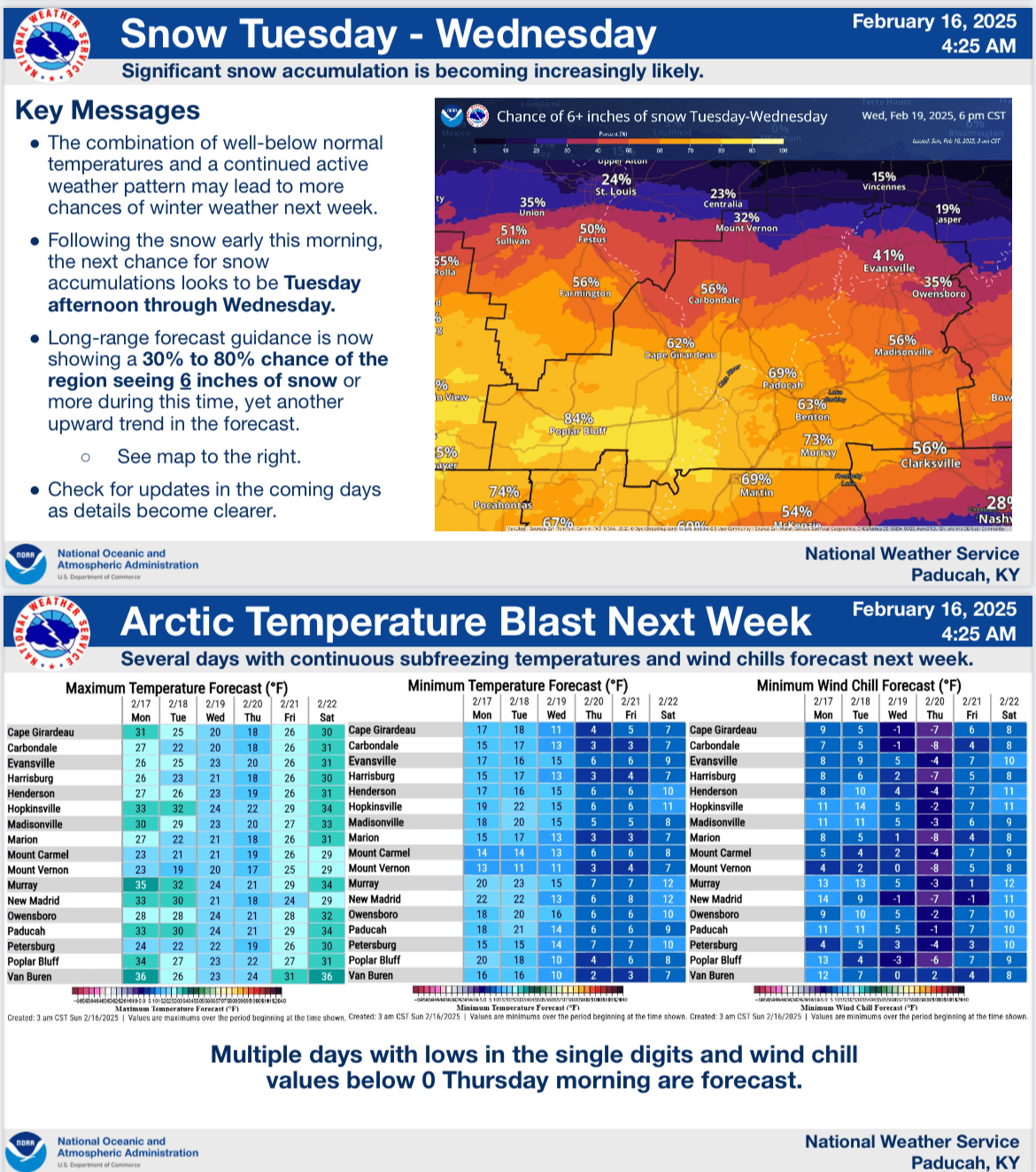
4. Arctic air, aided by snow cover, will result in very cold temperatures through the week with a couple nights of single digit lows, and negative wind chills Thursday morning.