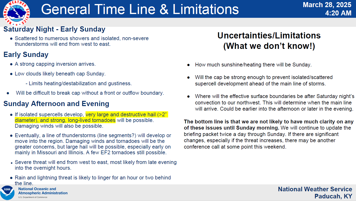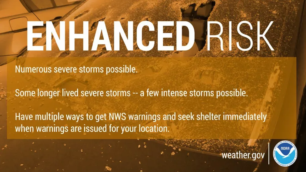
Western Kentucky is now under an enhanced risk for severe weather on Sunday as the National Weather Service bumped up the chances from the slight risk category on Friday.
Senior forecaster Daniel Spaeth says the conditions continue to change ahead of Sunday.
Spaeth says the severe weather will impact the region Sunday evening and Sunday night.
However, Spaeth warns there is a 10% chance we could see that worsen.
He says the winds will push the system through quickly, which means a low chance of flooding, although the rain could still be heavy.
Spaeth says conditions on Sunday will determine if we see tornado outbreaks ahead of the main line of storms, such as Memorial Day last year when storms out in front caused tornadoes in Lyon, Caldwell, and Hopkins counties.
Spaeth also says some rain moving through Saturday night shouldn’t reach severe status.
We will continue to monitor the weather this weekend and will provide more updates and live coverage if and when the severe weather impacts our area.