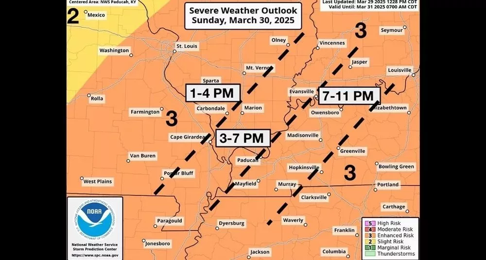
Western Kentucky remains at an enhanced risk level for severe weather for Sunday, but forecasters with the National Weather Service say confidence is growing an upgrade to a moderate risk is possible.
According to the National Weather Service, an extensive line of strong to severe thunderstorms are expected to develop and move through western Kentucky and the entire Quad State area from Sunday afternoon through the overnight hours.
All severe weather threats will be possible along and ahead of the approaching cold front, with the primary threats quarter size or larger hail, damaging wind gusts of 60 mph or greater, and possible strong, long-lived tornadoes. Forecasters also say capping ahead of the front may limit isolated cell development. However, they add that if a storm does form, there should be plenty of fuel for the storm to work with, increasing all hazard threats.
Additonally, heavy downpours are expected, although forecasters indicate the line of storms will likely move fast enough to limit the overall flash flooding risk.
In addition, it will be windy with gusts out of the south as high as 30-35 mph Sunday afternoon ahead of the cold front.
Your Weather Edge team will keep an eye on the weather for Sunday and provide more updates and live coverage if and when the severe weather affects our area.