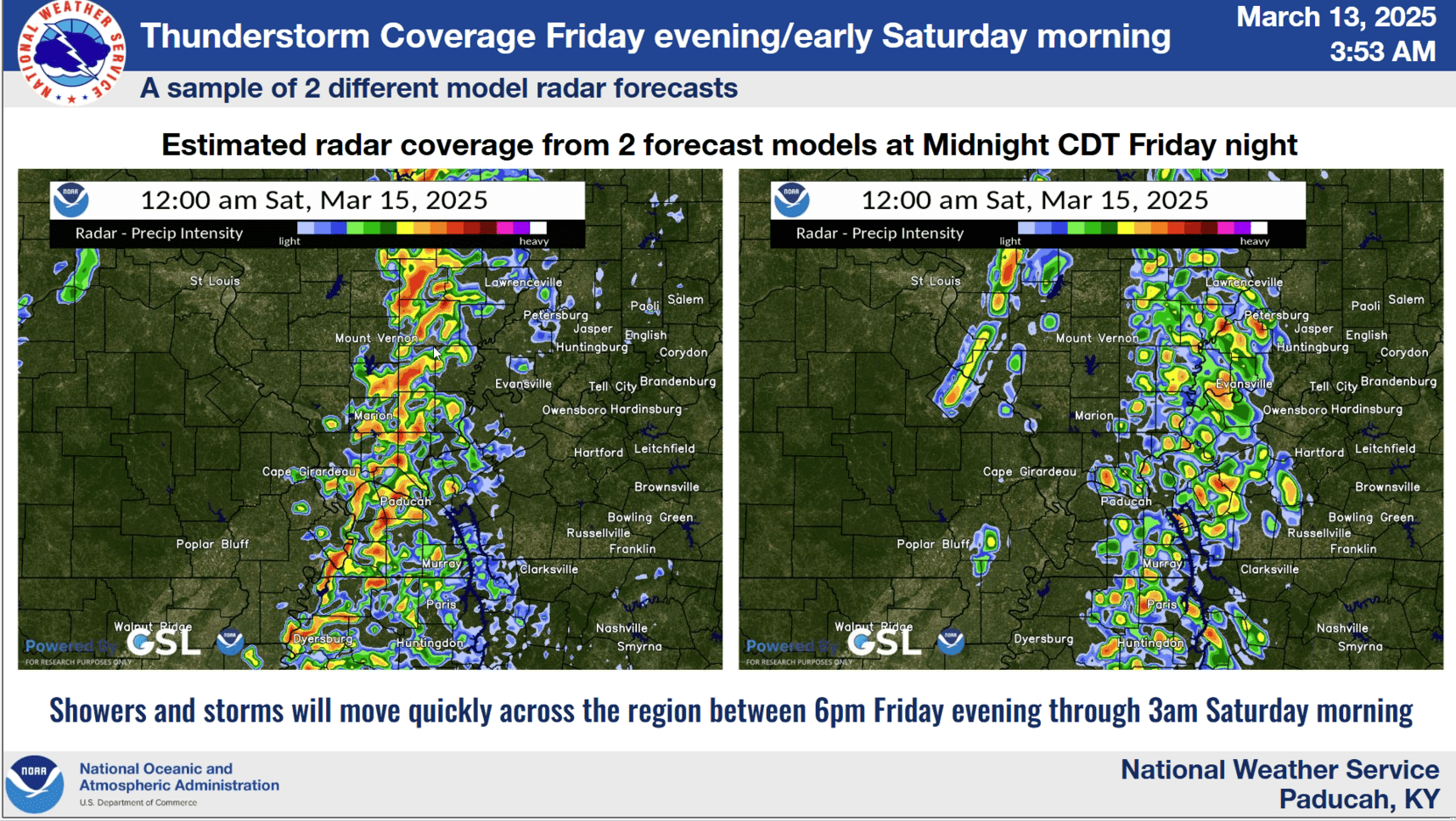
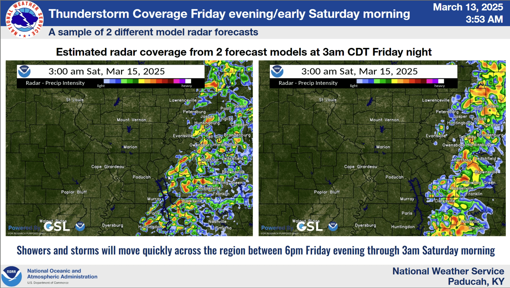
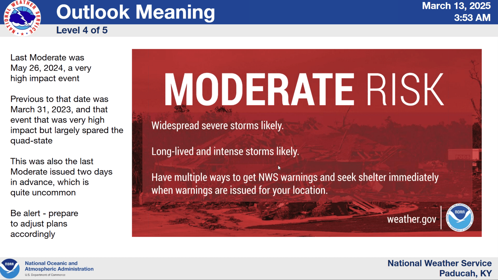
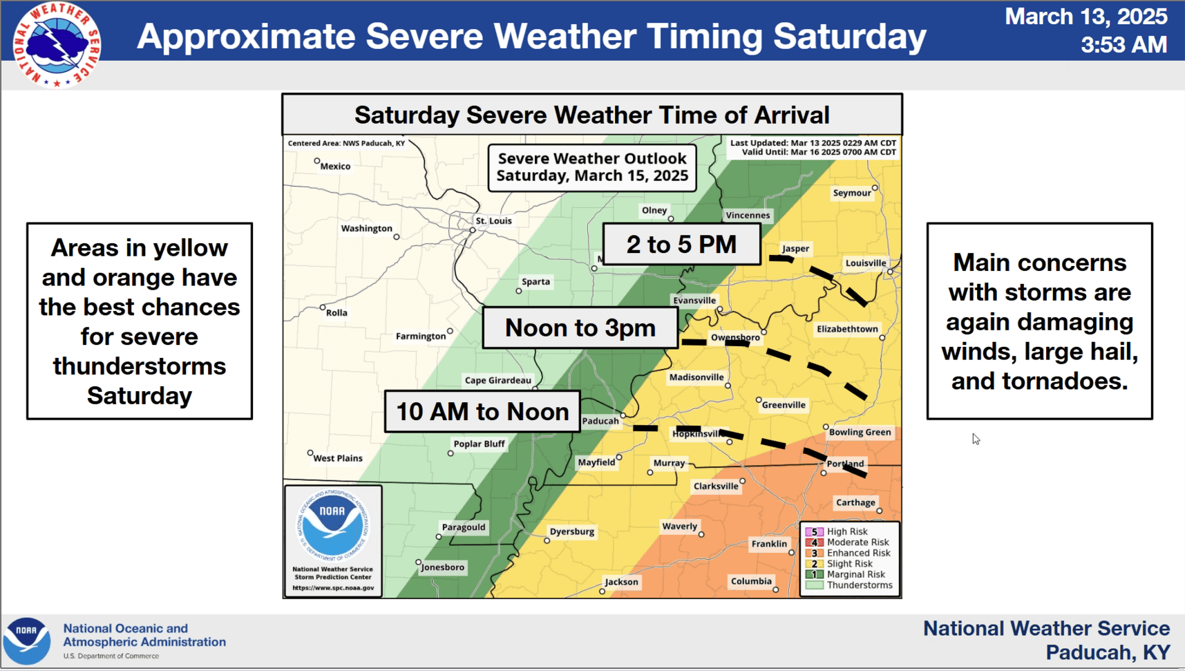
Western Kentucky is under an enhanced and moderate risk of severe weather, likely to move through the region late Friday night into early Saturday morning.
Keith Cooley, lead forecaster for the National Weather Service, says wind gusts between 35 and 50 mph will move through the area during the day Friday ahead of the storms. He says western Kentucky from the Misssissippi River east to Murray and north to Lyon County are under a moderate risk of severe weather with the area east of the lakes under an enhanced risk.
He says the severe weather is expected to reach the lakes around midnight and continue east through 3 am.
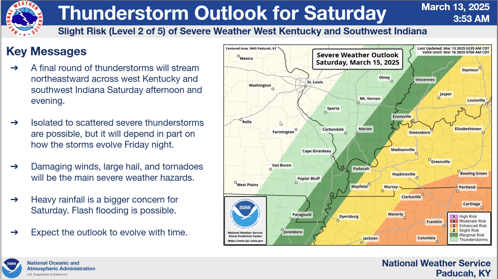
Once Friday’s system passes, another storm system will regenerate in western Kentucky and produce between two to three inches of rain with the possibility of some flash flooding.
After a brief cool down on Sunday, temperatures are expected to moderate early next week ahead of another potential storm system next Wednesday.
We will keep you apprised of any severe weather as it moves through Friday night and Saturday.